OF YOUR DATA
Map Observer
Map Observer provides visualisations of all content. It links directly to your database’s alphanumeric information and is connected to external data sources. It can therefore be used for a variety of tasks such as identifying spatial interrelations and displaying overviews. This makes Map Observer a powerful application that is quick and intuitive to use.
MAPS AND LAYERS
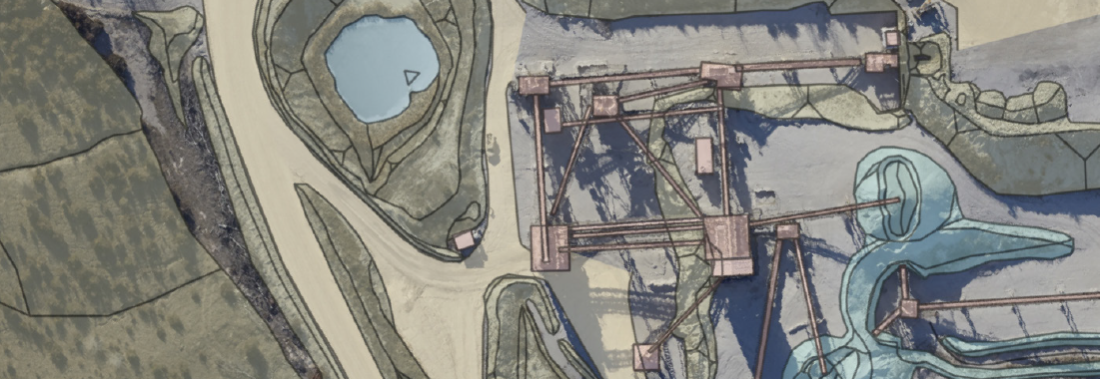
All stored and connected visual information and data converge in Map Observer and can be displayed as a map. Maps and layers can be activated individually and visualised accordingly in the map area. You can also use the Layer Manager to set the order and extent of the displayed layers.
DRAWINGS AND NOTES
Add notes to your maps and draw markings and sketches using point, line and area tools. Drawings and notes can be managed according to topic and location and over multiple layers. A share function enables the sharing of notes. Each note level can be individually approved for selected users for viewing (read-only) or for usage (read and write).
MEASURING
The maps have a range of functions for mea- suring lengths, areas and individual coordinate points. These are useful tools to assess a situation displayed on a map. Different coordinate systems and local projections can also be used and merged, with options to switch between them. This gives you the optimal overview.
INTERACTIVE OBJECTS
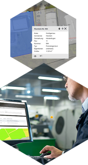
Geometric objects stored in the reGISter, such as land parcel boundaries and leasehold areas, can be selected interactively in Map Observer. An information window dis- plays an overview of core information such as land parcel number, area size and land owners.
3D OBSERVER (OPTIONAL)
The 3D Observer displays 3D models with texturing and/or aerial images. Detailed spatial interrelations can then be viewed as a rotatable and scalable model, with options such as measuring distances within the area.
PICTURE MODULE (OPTIONAL)
The Picture Module enables you to link photos and images to the Map Observer, label them and position them using the coordinates contained in a GPS tag, or manually save them at any position. Saved images are displayed as thumbnails on the map and listed and searchable as a table via reGISter‘s alphanumeric data.
More features
in Map Observer:
- Flexible user-based recording of map settings, such as active layers, sequence and transparency
- Import/export of geometrics/geodata
- Print functions for displayed maps
- Links to external data sources
- Downloads of original files
WITH COLLEAGUES & PARTNERS

reGISter Portal
The portal contains all core functions and is the basis for other applications. Use tools such as the User Management, Site Management, Document Management, Notifications or Global Data to keep your business up to date.
USER MANAGEMENT
User Management is for managing user and group rights and access. For example, access to private data can be restricted to specific users. When required, access can be flexibly managed according to specific func- tions and data.
DOCUMENT MANAGEMENT
The Document Management module stores information and documents such as contracts, construction applications and approvals, and links databases with documents and participating organisations. Any file format such as PDFs, Office documents, image files and data from other specialised software can be included. These are stored centrally on the server on which reGISter is installed which also functions as a document archive. You get full access to your files and can download them at any time.
Site MANAGEMENT
Site Management enables you to manage sites such as plant facilities, and mining and extraction areas. You can also incorporate special icons into maps as well as store master data and site-related documentation. Users with the relevant rights then gain diffe- rentiated access to site-related content.
NOTIFICATIONS
The notifications function enables you to send messages and reminders within the portal to the relevant users and user groups. For example, participating groups can be informed about new data records or the expiry of deadlines. Such notifications can also be sent as emails.
GLOBAL DATA
The global data area is used to manage all relevant master data. Data from companies and clients can be setup and assigned information. System data from land registries and other data can also be managed here. Easy searching and filtering are possible using the created contact groups and a global address book.
reGISter LITE
reGISter LITE offers a compact version of our product as an introductory system to digital map management.
reGISter LITE focuses on Map Observer visualisation of the geodata and maps entered via the portal. Detailed alphanumeric data and applications, such as Land Management, are not included, but can be added as required. Depending on the package purchased, you can add the number of users and locations you require. Worldwide availability, fast access, extremely high security standards, and encrypted data transfer make reGISter LITE ideal for sharing information between companies and external partners and public agencies. A monthly subscription gives you all the benefits of the reGISter Cloud server as well as the latest updates and new functions.
Land Management
Overview and management of your sites. In the application of Land Management, you can enter and structure graphical and alphanumerical information on parcels and arrange the associated basic data.
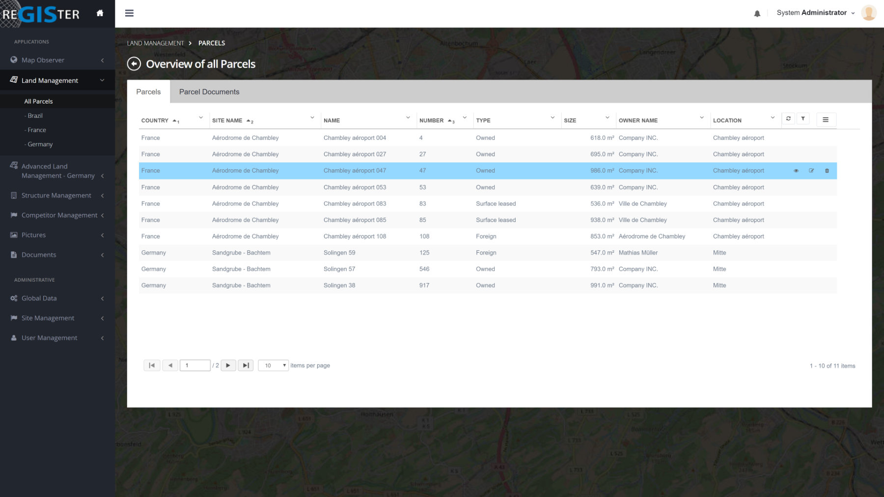
Land Management enables you to input graphical and alphanumeric information about the parcels of land, structure the data, and organise associated core information. Data such as land registry reference, municipality, parcel number, land owner, current occupier and area is input using the relevant fields and easily accessed and filtered using navigation functions. Geometrics for each land record are displayed and can be combined into a detailed map with other topics and map layers via Map Observer. Instant switching between the data and map is possible.
Any document and file can also be attached. An overview table means you always have control over the latest data and can easily create outputs and reports. Whether owned land, leased or third-party land, Land Management stores all master data and continuously tracks your current land information.
More features
in Land Management:
- Any land type owned, third-party property, leased etc.
- Quick and easy search and filter options in table format
- Export and easy evaluation via filters as CSV and PDF formats directly from the table overview
- Links land to locations
- Ability to input notes and comments as well as links to documentation
- Includes DE and EN language packs (other languages can be optionally included)
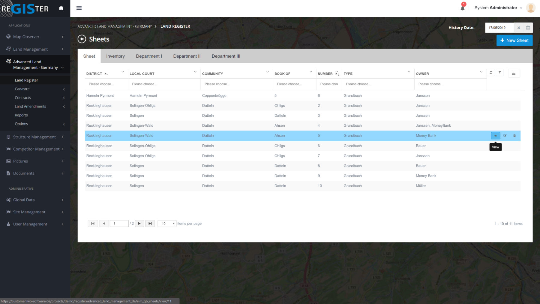
Advanced Land Management
Country-specific for Germany, USA, Belgium and Poland. Take advantage of advanced features such as Land Registry & Cadastre, History, Change Processes and Contracts.
ADVANCED LAND MANAGEMENT
Advanced Land Management allows you to manage land with additional information and to create different types of usage per land area. Different usage types can be given their own corresponding geometrics and visualised in a separate layer in Map Observer. In addition to land registry information, you can also manage access rights to land data such as your rights to third-party land or the rights of third parties to your land.
HISTORY
Data is protected from permanent deletion by a history function. Archived data then remains accessible. For example, the historical timeline of each parcel of land can be clearly displayed in tree format. By entering a date, you get the data as it was at the selected time.
CHANGE NOTIFICATION
Any changes within predefined processes are stored and documented. Sales and partitioning can then be traced at any time.
CONTRACTS
This area is used to create and manage contracts, such as tenancy, lease and service agreements. Core contract data such as contract partners, contract terms, leasehold land and other land as well as documentation can be directly linked and edited. A memory function helps you to keep track of dates and deadlines. You can add reminders to data records and receive reGISter notifications also by email prior to the expiry of a deadline.
Applications & Modules
A range of other applications and add-ons, such as Structure / Assets Management, Competitor Management, Sensor Monitoring, Drillhole Management, Interfaces
STRUCTURE / ASSET MANAGEMENT
Structure Management enables you to store and manage any type of structure, construction or facility building. Depending on the data type, inspections and other test reports can be stored and provided with correspon- ding information and documentation.
COMPETITOR MANAGEMENT
Competitor Management functions similarly to Site Management but focuses on your competitors. You can enter competitor information and the relevant locations. Individual icons can also be assigned here for visualisation in Map Observer. You can benefit from comment and document functions and, of course, set user-based access restrictions.
SENSOR MONITORING
Any sensor can be created in the Sensor Monitoring application and grouped by type. The measurement data acquired can be imported or manually input. Interfaces for the live streaming of sensor data are also available. There are also options to save reports and documentation. Sensor data can be visualised as points or geometrics in Map Observer. You can then evaluate the data using a variety of graph types. Time and data intervals can be selected as required.
DRILLHOLE MANAGEMENT
Drillhole Management stores information such as standard drill-hole data and positioning as well as images and drawings of individual drill cores. Chemical analyses of drill cores can be imported and divided into specific zones for further analysis. Interfaces to other software such as Surpac are also possible.
INTERFACES
Information, such as alphanumeric data, can be exported directly from predefined and filtered overview tables. Import and export interfaces can be added as required.

Contact us!
Info
fon. +49 212 250 851 – 0
fax. +49 212 250 851 – 17
info@iwo-group.com
Support
+49 212 250 851 – 0
support@register-geoportal.com